Our Services
Water Management Technologies
-
Control Center
-
SCADA
-
EPANET
-
GIS
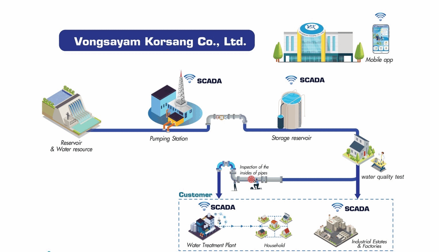
Raw Water
Control Center
The control center utilizes a standardized database management system operating from a central station (Master Centralized Control). This system oversees all commands and communications within the SCADA system, effectively managing water resources and the water grid to optimize water pumping for efficiency.
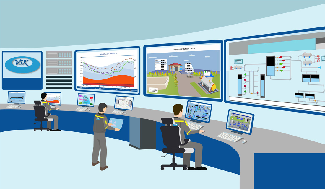
SCADA
SCADA (Supervisory Control And Data Acquisition) is a system designed to control water transportation and monitor various states, effectively managing water resources and the distribution grid to optimize water pumping for maximum efficiency using computer and electronic equipment. It enables real-time, 24/7 automatic water distribution, data collection, system monitoring, and alert provision, facilitating timely management, planning, and response to emergencies in a timely manner.
EPANET
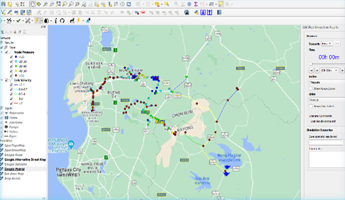
The program is utilized for analyzing hydraulics and water quality, aiding in the assessment of pipe systems and management of water pressure. It simulates adjustments to the scope of water distribution to align with varying water demands across different areas. The company integrates this program into project operations to evaluate the correlation between water demand and pipe size, ensuring the appropriate pressure levels within the pipeline.
GIS: Geographic Information System
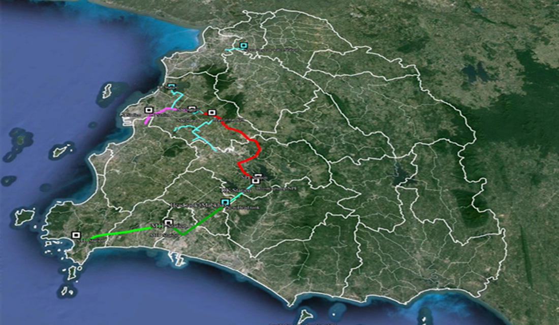
GIS, or Geographic Information System, is a technology that integrates geographic data like maps, satellite images, and spatial data into computer-based analysis. It generates precise results tied to spatial locations. The company utilizes GIS for planning, management, communication, and project site identification, such as communicating pipeline routes with customers and evaluating guidelines for piping.
Customer Service
Subscribe
CallAction